
CXC Home | Search | Help | Image Use Policy | Latest Images | Privacy | Accessibility | Glossary | Q&A
Icelandic Volcanoes and the Greenland Ice Sheet Connection
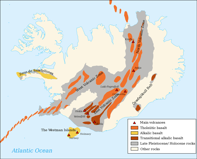
Iceland and the mid-Atlantic Ridge
Iceland is located mostly south of the Arctic Circle in the North Atlantic Ocean, less than 200 miles across the Denmark Strait from the coast of Greenland. Iceland has a unique geological location on top of the mid-Atlantic Ridge, a divergent plate boundary between the North American Plate and the Eurasian Plate. The island – roughly the size of the state of Virginia – has 130 active volcanoes and is commonly referred to as the “Land of Fire and Ice.” Because its history has always been closely related to volcanism, many volcanic eruptions since the middle ages have been recorded and preserved. Iceland was settled in 834 AD, established its own parliament in 930 AD and recorded its first historical volcanic eruption ~934 AD, during which Eldagia, the longest volcanic fissure in the world, was created. Due to the amount of volcanic activity – averaging one every three years – and the resulting devastation to the country of Iceland from lava, ash and sometimes years of famine, there is a well documented record of Icelandic volcanic eruptions. The volcanic materials settle onto the nearby Greenland ice sheet and become incorporated into the ice core record.
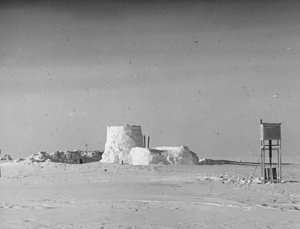
Eismitte Camp, Greenland, 1930-1931
The first arctic research expedition to study the interior of Greenland took place from July, 1930 through August, 1931. The campsite, called Eismitte (Ice-Center), was located 402 kilometers from the coast at an estimated altitude of 3,000 meters. Eismitte was part of an expedition led by the noted German scientist Alfred Wegener that would eventually establish two additional campsites to study the ice sheet and its climate.
Glaciologist Ernst Sorge was a member of the small group that established Eismitte. He built a snow cave that he lived in for the next seven months. Adjacent to the cave Sorge hand-dug a 15 meter deep pit, then systematically and quantitatively studied the near-surface snow/firn strata from inside the pit. After meticulous examination of the structural features and careful measurement of continuous density and other physical properties within the pit profile, Sorge determined the characteristics of the individual limits of annual snow accumulation. This research validated the feasibility of measuring the preserved annual snow accumulation cycles.
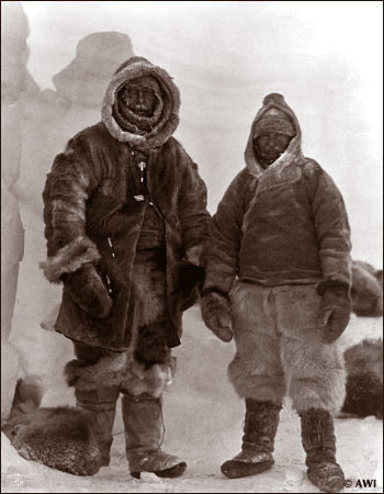
Wegener (left) & Villumsen
November 1st, 1930
Frequent bad weather delayed the transportation of supplies from the ship to the base of the ice sheet and subsequently to Eismitte. Wegener mistakenly thought that Sorge and his companions did not have enough supplies to last through the winter and he led a party of thirteen Icelanders and meteorologist Fritz Lowe to Eismitte to deliver supplies. After traveling for 40 days, Wegener, Lowe, and one Icelander – Rasmus Villumsen – reached the camp; the other twelve Icelanders having returned to the base camp on the coast.
Two days later, on November 1st, the members of the expedition celebrated Wegener’s 50th birthday. Fritz Lowe, still exhausted and suffering from frostbite, remained at Eismitte while Wegener and Villumsen – both in excellent shape and not wanting to use any of the rations brought for those remaining at the camp – left to return to the coast. No one would see either of them alive again.
Wegener (left) & Villumsen
November 1st, 1930
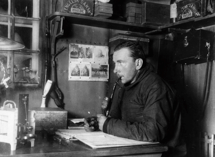
Alfred Wegener's body was eventually found by a search party. It appeared that he had died in his tent and Rasmus Villumsen had buried him and marked the site with crossed skies before setting off to continue his journey to base camp. No evidence was ever found of Villumsen. A mausoleum constructed from ice was built over Wegener’s body and a 20-foot iron cross erected to mark the site. The grave of Alfred Wegener has long since vanished beneath the snow to become part of the great Greenland ice sheet. Wegener first proposed the theory of continental drift and was ridiculed by most prominent scientists of the time as he could not provide evidence of the mechanism that would drive drifting continents. Eventually plate tectonics would prove to be the mechanism, and Iceland – the Land of Fire and Ice right next door to the Greenland ice sheet – is defined by its position astride two diverging plates – providing the mechanism for "drifting continents".
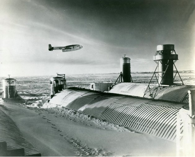
Camp Century, Greenland, late 1950's
Mobile Nuclear Power Plant
Drilling into polar ice sheets was first accomplished in 1956, just prior to the International Geophysical Year, at Site 2, northwest Greenland. After two attempts in 1961 and 1962 at Camp Century, a third core site was started in 1663 and re-cored using different drills. In July, 1966 the drill reached the base of the ice sheet. The 1390-meter deep ice core provided evidence of three separate climatic oscillations.
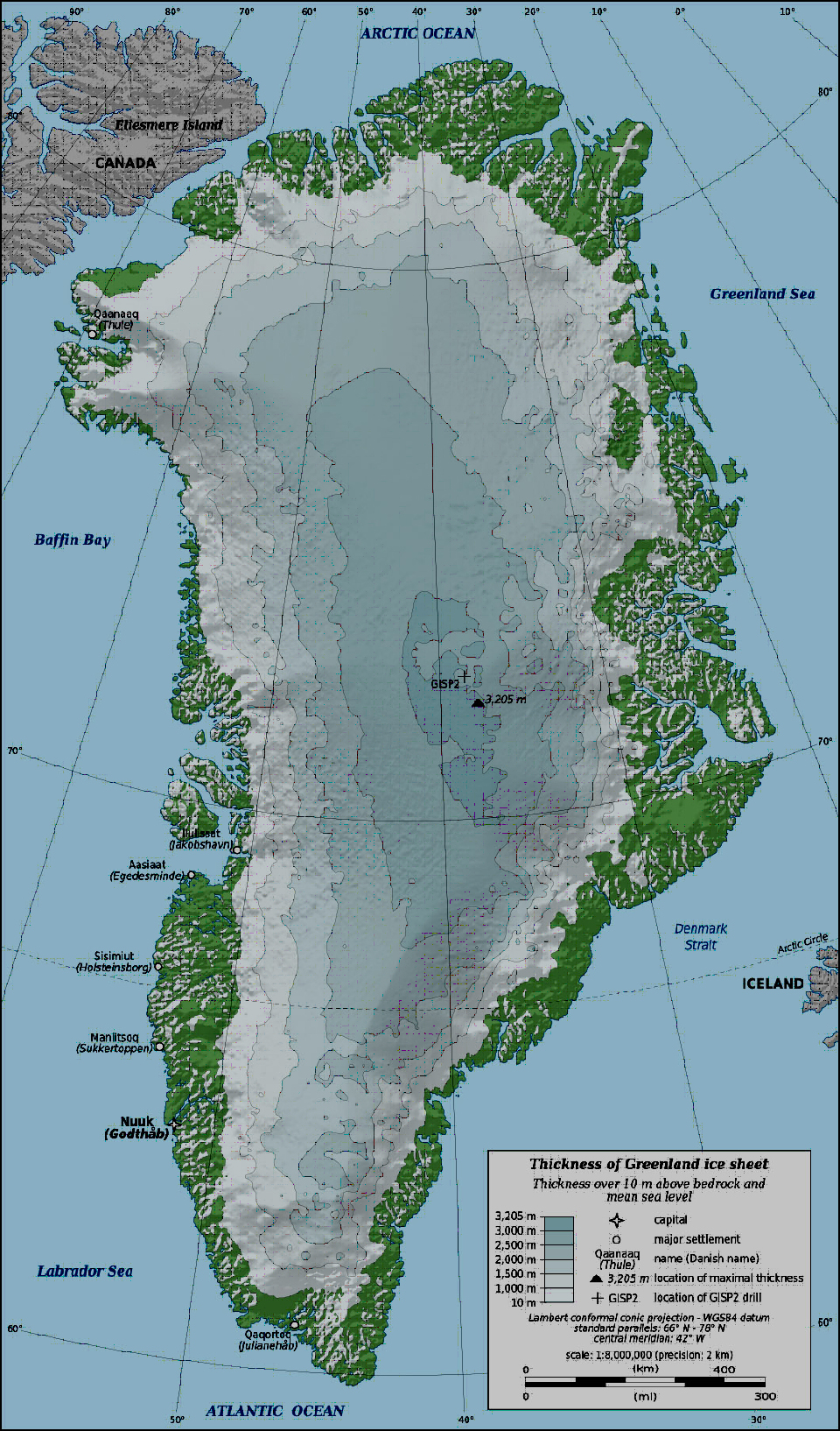
Greenland and Iceland
The Icelandic volcano signature – opposed dual anomalies of high conductivity and low nitrates – provide time markers to use absolute dating techniques for events recorded within the Greenland ice core. The Icelandic eruptions release most of their products into the upper troposphere and deposition usually occurs with a few days to a couple of weeks. Volcanic eruptions at mid to equatorial latitudes must be powerful enough to eject some of their materials up into the stratosphere for global circulation patterns to transport them to the Polar Regions. This results in up to a one-year delay from eruption to deposition on the Greenland ice sheet if the eruption occurred in the southern hemisphere. The dating of volcanic activity with the conductivity record, added with the ability to distinguish general geographical latitudes, provides supporting evidence to date the solar nitrate record.
Back to Ice Core Index
Revised: January 30, 2012